
Articles

Understanding the management and governance of Australia’s vast coastline can be complex.
Sponge taxonomy is difficult and challenging, it requires adequate laboratory facilities, experience and time, which are often not available.
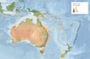
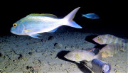
Species richness is a count of the number of different species that exist in a given region or ecological community.

Wetlands are a critical part of our natural environment. They protect our shores from wave action, reduce the impacts of floods, absorb pollutants and improve water quality.
World Heritage Areas are places that are considered to be of outstanding value to humanity.
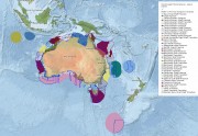
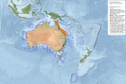
The Integrated Marine and Coastal Regionalisation of Australia (IMCRA v4.0) classified Australia's marine environment into ecologically rel
The Integrated Marine and Coastal Regionalisation of Australia (IMCRA v4.0) classified Australia's marine environment into ecologically rel
The Key Ecological Features (KEFs) are parts of the marine ecosystem that are considered to be of particular importance for either a region's biodiversity or its ecosystem function and integrity.